Topo kort og elevation data .
FromJames Associates: Camp, geocache, off-road, vandre og cykle Alabama i stil! James Associates, Inc., producent af MacGPS Pro-software, tilbyder nu MacTopos Alabama til den ultimative topografiske digitale kortløsning. En DVD til Alabama indeholder USGS topo-kort til hele staten i tre krystalklare kortskalaer: 1: 24K, 1: 100K og 1: 250K, plus US Forest Service 1: 24K kort og digital højde data. ...
Omdirigering til et sikkert websted. Vi tjekker Hvis linket virker. Vent venligst ...
You can report broken links into broken@dailydownloaded.com. Our editors will review them shortly.
Topo kort og elevation data
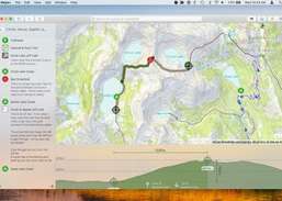
Kort til Vandring, Jagt andamp; Stier