Geographic Imager Specifications
|
Tool for working with spatial imagery in Photoshop.

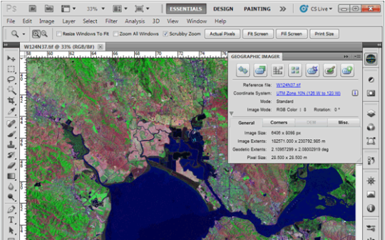
FromAvenza Systems:Geographic Imager is powerful software for working with spatial imagery in Adobe Photoshop that leverages the superior image editing capabilities of this raster-based image-editing software and transforms it into a powerful spatial imagery editing tool. Work with satellite imagery, aerial photography, orthophotos, and DEMs in GeoTIFF and other major GIS image formats using Adobe Photoshop features such as transparencies, filters, and image adjustments while maintaining georeferencing and support for hundreds of coordinate systems and projections.
Download
Stitch 360 degree panorama for mac and export Flash VR, HTML5, QuickTime VR.
Stitch 360 degree panorama for mac and export Flash VR, HTML5, QuickTime VR.
Enhance your existing images and create new ones using every image editing tool you could ever need.
|
|
|
|
|
|
|
|
|
|
|
|
|
|
|
|
|
|
|
|